Loch Lomond & The Trossachs
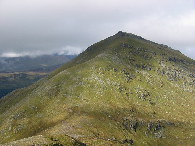
The park straddles the Highland Boundary Fault, so lowland oak woods and island-studded Loch Lomond sit minutes from genuine Highland hills — Ben Lomond, the most southerly Munro, the craggy Arrochar Alps and the Crianlarich mountains. Its Munros and Corbetts are the closest to Glasgow, which makes the honeypot areas busy and the quieter corners surprisingly empty.

- Country
- Scotland
- Area
- 1,865 km²
- Designated
- 2002
- Listed hills
- 63
- Highest listed hill
- Ben More 1173.9 m
Access in this park
Scotland’s right of responsible access applies, but seasonal camping-management byelaws (roughly March–September) mean camping in the defined lochshore zones needs a permit or a designated site, despite the general Scottish position.
Yes Right to roam (Scotland): Statutory right of responsible access to most land and inland water.
Yes Wild camping (Scotland): Wild camping is broadly lawful under the 2003 Act.
In defined Camping Management Zones (roughly 1 March – 30 September) camping requires a permit or use of a designated site, despite the general Scottish access right. Zones cover parts of east Loch Lomond, Trossachs lochshores and other honeypot areas.
Designation as a park creates no right of access in itself — the law of Scotland applies inside the boundary, and park byelaws, seasonal restrictions and closures can override the general position. This is general information, not legal advice. Full detail:access rights in Scotland ·check a specific grid reference.
All 63 listed hills, tallest first
Every summit from our hill dataset whose summit point falls inside the park boundary. Follow a name for its full record, live summit weather and daylight times.
| # | Hill | Height | Classifications | Grid ref |
|---|---|---|---|---|
| 1 | Ben More | 1173.9 m | MunroCurrent County/UA TopTrail 100+4 | NN432244 |
| 2 | Stob Binnein | 1164.8 m | MunroMurdoMarilyn+2 | NN434227 |
| 3 | Ben Lui | 1131.4 m | MunroTrail 100Murdo+3 | NN266262 |
| 4 | Stob Coire an Lochain | 1067.3 m | Munro Top | NN438220 |
| 5 | Cruach Ardrain | 1045.9 m | MunroMurdoMarilyn+2 | NN409212 |
| 6 | Ben Oss | 1029.8 m | MunroMurdoMarilyn+2 | NN287253 |
| 7 | Beinn Ime | 1012.2 m | MunroMurdoMarilyn+2 | NN254084 |
| 8 | An Caisteal | 995.9 m | MunroMurdoMarilyn+2 | NN378193 |
| 9 | Ben Vorlich | 985.3 m | MunroMurdoMarilyn+2 | NN629189 |
| 10 | Beinn Dubhchraig | 978.6 m | MunroMurdoMarilyn+2 | NN307254 |
| 11 | Ben Lomond | 973.7 m | MunroHistoric County TopTrail 100+4 | NN367028 |
| 12 | Stuc a' Chroin | 973 m | MunroMurdoMarilyn+2 | NN617174 |
| 13 | Meall na Dige | 965.5 m | Munro TopMurdoSimm | NN450225 |
| 14 | Stob Garbh | 957.7 m | Munro TopMurdoHuMP+1 | NN411221 |
| 15 | Beinn Tulaichean | 945.8 m | MunroMurdoHuMP+1 | NN416196 |
| 16 | Ben Vorlich | 942.8 m | MunroHistoric County TopMurdo+3 | NN295124 |
| 17 | Beinn a' Chroin | 941.4 m | MunroMurdoHuMP+1 | NN387185 |
| 18 | Beinn a' Chroin East Top | 940.1 m | Munro TopMurdoSimm | NN393185 |
| 19 | Beinn Chabhair | 932.2 m | MunroMurdoMarilyn+2 | NN367179 |
| 20 | Ben Vorlich North Top | 932.1 m | Munro Top | NN294130 |
| 21 | Beinn Narnain | 926.8 m | MunroMurdoMarilyn+2 | NN271066 |
| 22 | Sgiath Chuil | 920.1 m | MunroMurdoMarilyn+2 | NN462317 |
| 23 | Meall a' Churain | 917.3 m | Munro Top | NN462324 |
| 24 | Ben Vane | 915.8 m | MunroMurdoMarilyn+2 | NN277098 |
| 25 | Beinn an Lochain | 901.7 m | CorbettMarilynHuMP+1 | NN218078 |
| 26 | The Cobbler | 884 m | CorbettTrail 100Marilyn+2 | NN259058 |
| 27 | Ben Ledi | 879 m | CorbettMarilynHuMP+1 | NN562097 |
| 28 | Stob a' Choin | 867.2 m | CorbettMarilynHuMP+1 | NN417159 |
| 29 | Beinn Luibhean | 859.7 m | CorbettMarilynHuMP+1 | NN242079 |
| 30 | Meall an t-Seallaidh | 852.7 m | CorbettMarilynHuMP+1 | NN542234 |
| 31 | Ben Donich | 847 m | CorbettMarilynHuMP+1 | NN218043 |
| 32 | Benvane | 821 m | CorbettMarilynHuMP+1 | NN535137 |
| 33 | Beinn Chaorach | 818 m | CorbettMarilynHuMP+1 | NN358328 |
| 34 | Stob Coire Creagach | 817.8 m | CorbettMarilynHuMP+1 | NN230109 |
| 35 | Beinn Each | 811.2 m | CorbettMarilynHuMP+1 | NN601158 |
| 36 | Creag Mac Ranaich | 808.6 m | CorbettMarilynHuMP+1 | NN545255 |
| 37 | The Brack | 787.5 m | CorbettMarilynHuMP+1 | NN245030 |
| 38 | Beinn Bheula | 779 m | CorbettMarilynHuMP+1 | NS154983 |
| 39 | Beinn Stacach | 771.8 m | CorbettMarilynHuMP+1 | NN474163 |
| 40 | Beinn a' Choin | 768.7 m | CorbettMarilynHuMP+1 | NN354130 |
| 41 | Cnoc Coinnich | 763.5 m | CorbettMarilynHuMP+1 | NN233007 |
| 42 | The Stob | 753.6 m | GrahamMarilynHuMP+1 | NN491231 |
| 43 | Meall Mor | 746 m | GrahamMarilynHuMP+1 | NN383151 |
| 44 | Beinn Mhor | 741.5 m | GrahamMarilynHuMP+1 | NS107908 |
| 45 | Ben Venue | 729 m | GrahamMarilynHuMP+1 | NN474063 |
| 46 | Meall Buidhe | 719.2 m | GrahamMarilynHuMP+1 | NN576275 |
| 47 | Beinn Chaorach | 713 m | GrahamMarilynHuMP+1 | NS287923 |
| 48 | Beinn Eich | 701.5 m | GrahamMarilynHuMP+1 | NS302946 |
| 49 | Stob Breac | 686.4 m | GrahamMarilynHuMP+1 | NN447166 |
| 50 | Beinn Damhain | 684.2 m | GrahamMarilynHuMP+1 | NN282172 |
| 51 | Beinn Bhreac | 680.8 m | GrahamMarilynHuMP+1 | NN321000 |
| 52 | Beinn Ruadh | 664.6 m | GrahamMarilynHuMP+1 | NS155884 |
| 53 | Creag Mhor | 659.8 m | GrahamMarilynHuMP+1 | NN510185 |
| 54 | Meall Odhar | 656.9 m | GrahamMarilynHuMP+1 | NN297298 |
| 55 | Mid Hill | 656.9 m | GrahamMarilynHuMP+1 | NS321962 |
| 56 | Fiarach | 652.2 m | GrahamMarilynHuMP+1 | NN344261 |
| 57 | Sgiath a' Chaise | 644.2 m | GrahamMarilynHuMP+1 | NN583169 |
| 58 | Creag Tharsuinn | 643 m | GrahamMarilynHuMP+1 | NS087913 |
| 59 | Tullich Hill | 633.1 m | GrahamMarilynHuMP+1 | NN293006 |
| 60 | Cruinn a' Bheinn | 632.5 m | GrahamMarilynHuMP+1 | NN365051 |
| 61 | Beinn Bheag | 619.8 m | GrahamMarilynHuMP+1 | NS125931 |
| 62 | Cruach nam Mult | 611.2 m | GrahamMarilynHuMP+1 | NN168056 |
| 63 | Cruach nam Miseag | 607 m | GrahamMarilynHuMP+1 | NS182981 |
Hill data from the Database of British & Irish Hills v18.3 (CC BY 4.0); park boundaries from the Office for National Statistics (OGL v3.0). Hills are assigned to a park by summit position, so a top just outside the boundary will not appear here even if the walk starts inside it.
Long-distance paths through Loch Lomond & The Trossachs
8 waymarked long-distance routes cross the park boundary. Distances are for the whole route, not just the section inside the park.
| Route | Total length | Countries |
|---|---|---|
| John Muir WayNational Trail | 205 km · 127 mi | Scotland |
| Rob Roy WayNational Trail | 176 km · 110 mi | Scotland |
| West Highland WayNational Trail | 153 km · 95 mi | Scotland |
| Three Saints Way | 97 km · 60 mi | Scotland |
| Loch Lomond and Cowal WayNational Trail | 91 km · 56 mi | Scotland |
| Three Lochs WayNational Trail | 54 km · 34 mi | Scotland |
| Great Trossachs PathNational Trail | 49 km · 30 mi | Scotland |
| Mary Queen of Scots Way | 42 km · 26 mi | Scotland |
Route lines © OpenStreetMap contributors (ODbL); park crossings computed by OpenFell against the ONS park boundary. See all UK long-distance paths.
Plan a walk here
- Walking-time calculator — Naismith with terrain and fitness corrections.
- Daylight safety planner — set your turnaround against sunset.
- Access checker — what a specific grid reference allows.
- Access rights in Scotland — roaming, paths, camping and dogs in detail.
- Safety notes — conditions change fast; build in margin.