Peak District
Britain’s first national park, split between the gritstone moors and edges of the Dark Peak — Kinder Scout (636 m) was the scene of the 1932 mass trespass — and the limestone dales of the White Peak. Ringed by major cities, it is laced with paths, gritstone edges and open moorland crossings.
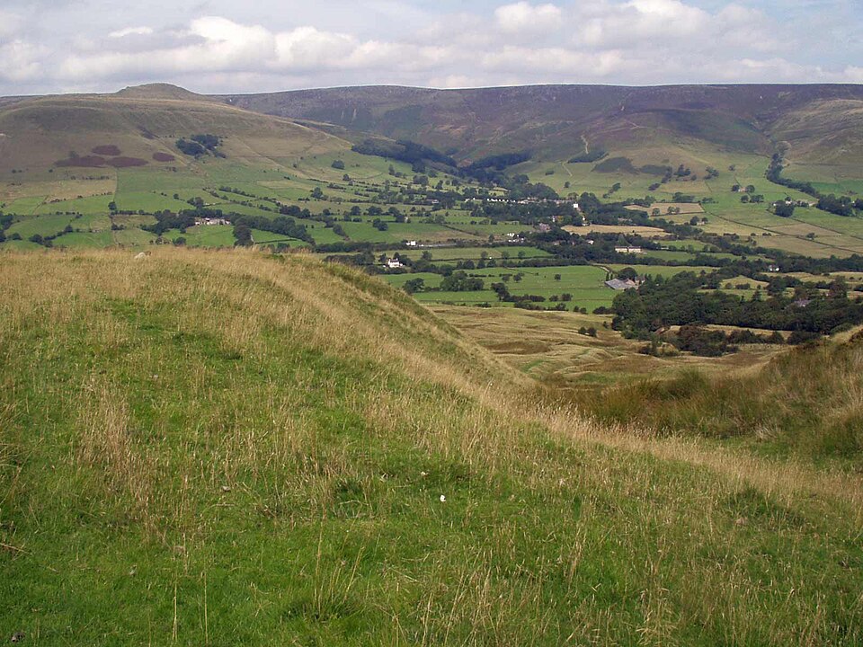

- Country
- England
- Area
- 1,437 km²
- Designated
- 1951
- Listed hills
- 24
- Highest listed hill
- Kinder Scout 636.3 m
Access in this park
The Dark Peak moors that sparked the 1932 trespass are now mapped CRoW open access land, as is much of the park’s upland. Wild camping needs the landowner’s permission.
Conditional Right to roam (England): Right to roam only on mapped CRoW open access land.
Conditional Wild camping (England): Permission needed — except on the Dartmoor commons.
Designation as a park creates no right of access in itself — the law of England applies inside the boundary, and park byelaws, seasonal restrictions and closures can override the general position. This is general information, not legal advice. Full detail:access rights in England ·check a specific grid reference.
All 24 listed hills, tallest first
Every summit from our hill dataset whose summit point falls inside the park boundary. Follow a name for its full record, live summit weather and daylight times.
| # | Hill | Height | Classifications | Grid ref |
|---|---|---|---|---|
| 1 | Kinder Scout | 636.3 m | HewittNuttallHistoric County Top+5 | SK084875 |
| 2 | Bleaklow Head | 633 m | HewittNuttallHuMP+1 | SK094960 |
| 3 | Higher Shelf Stones | 621.8 m | Nuttall | SK088947 |
| 4 | Black Hill | 581.1 m | Historic County TopCurrent County/UA TopMarilyn+2 | SE078047 |
| 5 | Brown Knoll | 569 m | Dewey | SK083851 |
| 6 | Shining Tor | 559 m | Current County/UA TopMarilynHuMP+1 | SJ994737 |
| 7 | Axe Edge Moor | 551 m | Dewey | SK035706 |
| 8 | Howden Edge | 550 m | Current County/UA TopDewey | SK187943 |
| 9 | Lord's Seat | 550 m | Dewey | SK111834 |
| 10 | Whetstone Ridge | 547 m | Dewey | SK001708 |
| 11 | Featherbed Top | 544 m | Dewey | SK090920 |
| 12 | Mill Hill | 544 m | Dewey | SK061904 |
| 13 | Black Chew Head | 542 m | Current County/UA TopDewey | SE056019 |
| 14 | Back Tor | 538 m | Dewey | SK197909 |
| 15 | Horse Stone Naze | 527 m | Dewey | SK158975 |
| 16 | Cats Tor | 522 m | Dewey | SJ994758 |
| 17 | Cheeks Hill (boundary) | 518.9 m | Historic County TopCurrent County/UA Top | SK026699 |
| 18 | Mam Tor | 517 m | Dewey | SK127836 |
| 19 | Oliver Hill | 513 m | Dewey | SK027675 |
| 20 | Black Edge | 506.7 m | Dewey | SK062771 |
| 21 | Shutlingsloe | 506 m | HuMPDewey | SJ976695 |
| 22 | The Roaches | 505 m | HuMPDewey | SK001638 |
| 23 | Combs Head | 503 m | Dewey | SK040757 |
| 24 | West Nab | 501 m | Dewey | SE076087 |
Hill data from the Database of British & Irish Hills v18.3 (CC BY 4.0); park boundaries from the Office for National Statistics (OGL v3.0). Hills are assigned to a park by summit position, so a top just outside the boundary will not appear here even if the walk starts inside it.
Long-distance paths through Peak District
10 waymarked long-distance routes cross the park boundary. Distances are for the whole route, not just the section inside the park.
| Route | Total length | Countries |
|---|---|---|
| Trans-Pennine Trail | 426 km · 265 mi | England |
| Pennine WayNational Trail | 411 km · 256 mi | England, Scotland |
| Midshires Way | 364 km · 226 mi | England |
| Kirklees Way | 123 km · 76 mi | England |
| North Cheshire Way | 117 km · 73 mi | England |
| Sheffield Country Walk | 89 km · 55 mi | England |
| Derwent Valley Heritage Way | 84 km · 52 mi | England |
| Dane Valley Way | 78 km · 48 mi | England |
| Limestone Way | 75 km · 47 mi | England |
| Gritstone Trail (Disley - River Dane) | 33 km · 21 mi | England |
Route lines © OpenStreetMap contributors (ODbL); park crossings computed by OpenFell against the ONS park boundary. See all UK long-distance paths.
Plan a walk here
- Walking-time calculator — Naismith with terrain and fitness corrections.
- Daylight safety planner — set your turnaround against sunset.
- Access checker — what a specific grid reference allows.
- Access rights in England — roaming, paths, camping and dogs in detail.
- Safety notes — conditions change fast; build in margin.