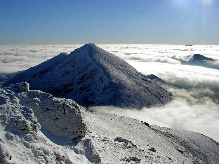
Stob Binnein
4 classifications here — Marilyn, HuMP, Simm and Murdo — belong to lists OpenFell holds only part of, so they have no list page. See how far the coverage goes.

- Height
- 1164.8 m · 3,822 ft
- Prominence
- 304.4 m
- Grid reference
- NN 43483 22703
- Coordinates
- 56.37071, -4.53577
- County / area
- Stirling
- Region
- Loch Lomond to Strathyre
- OS Landranger
- 51
- OS Explorer
- OL46N 365N
- Summit feature
- cairn
- Key col
- NN 4323 2358 (860.4 m)
About Stob Binnein
Stob Binnein forms a twin with Ben More (1,174 m) above Crianlarich in the southern Highlands, the two divided by the Bealach-eadar-dà-Bheinn, 'pass between two hills'. The pair are commonly walked together, using that bealach, with a descent available straight down to Benmore Burn.
The alternative is from the south, starting near Inverlochlarig some eight kilometres from Balquhidder, with about five kilometres of climbing from the glen along the southern ridge over the minor tops of Stob Invercarnaig and Stob Coire an Lochain.
Background written from facts in the Wikipedia article on Stob Binnein (CC BY-SA 4.0). Heights, prominence and grid references come from the Database of British & Irish Hills, not from Wikipedia.
Access rights here
Yes Right to roam: Statutory right of responsible access to most land and inland water.
Yes Wild camping: Wild camping is broadly lawful under the 2003 Act.
In defined Camping Management Zones (roughly 1 March – 30 September) camping requires a permit or use of a designated site, despite the general Scottish access right. Zones cover parts of east Loch Lomond, Trossachs lochshores and other honeypot areas.
General position for Scotland — local byelaws, seasonal restrictions and closures can override it. Full details: access rights in Scotland ·check another location.
Daylight at this summit today
- Sunrise
- —
- Sunset
- —
- Daylight
- —
- Civil twilight ends
- —
Computed astronomically for 56.371, -4.536. Plan your finish with the daylight safety planner.
Summit weather live
Loading forecast for the summit (1165 m)…
Forecast adjusted to summit altitude. Weather data from MET Norway (CC BY 4.0).
Finding the summit
The recorded summit point is cairn. On broad or flat summits the obvious cairn is not always the true high point.
- Survey method
- Leica RX1250
- Record revised
- 15-Dec-24
- Drop measured from
- NN 4323 2358 · 860.4 m
Survey notes are field observations recorded in the Database of British & Irish Hills (v18.3, CC BY 4.0) by the hill-surveying community.
Reaching Stob Binnein by train
One National Rail station sits within 8 km of the summit — close enough to make a car-free day of it. Distances are straight lines, not walking routes.
| Station | From summit | Summit lies |
|---|---|---|
| Crianlarich | 5.5 km | SE of the station |
Each station page lists every hill in its reach, long-distance paths from the door and a live-times link — see all stations with hills in reach. Station positions from NaPTAN (OGL v3.0).
The Stob Binnein group
2 other listed summits sit in the same prominence group, with Stob Binnein as the independent hill at its head.
| Summit | Height | Drop |
|---|---|---|
| Stob Coire an Lochain | 1,067 m | 23 m |
| Meall na Dige | 966 m | 82 m |
Grouping is by prominence alone: a summit belongs to the nearest higher Marilyn it connects to without a deeper intervening col. Over a large massif that can gather hills no one would walk in a single day, and which few would describe as parts of the same mountain — it is a measure of independence, not a suggested route.
Nearest listed peaks
| Peak | Height | Distance |
|---|---|---|
| Stob Coire an Lochain | 1067.3 m | 0.8 km |
| Meall na Dige | 965.5 m | 1.6 km |
| Ben More | 1173.9 m | 1.7 km |
| Stob Garbh | 957.7 m | 2.4 km |
| Cruach Ardrain | 1045.9 m | 3 km |
| Beinn Tulaichean | 945.8 m | 3.6 km |