Dartmoor
The largest area of open upland in southern England: a granite dome of rolling moor studded with tors and blanket bog, and rich in prehistoric remains. Its twin high points, High Willhays (622 m) and Yes Tor, rise on the northern moor inside an MOD range area, so check published firing times before heading that way.
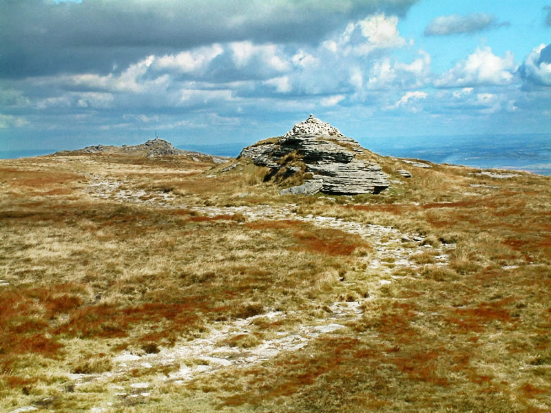

Dartmoor is ground the editor knows first-hand: Ryan has led a Ten Tors team across these moors, where the navigation problem is rarely the climb and almost always the visibility, the bog and the clock.
- Country
- England
- Area
- 953 km²
- Designated
- 1951
- Listed hills
- 15
- Highest listed hill
- High Willhays 622 m
Access in this park
Much of the moor is CRoW access land and registered common, and Dartmoor is the one place in England with a confirmed legal right to backpack camp — on the commons, following the Supreme Court’s 2025 Darwall ruling. Follow the park authority’s camping map and code, and check MOD firing times for the northern moor.
Conditional Right to roam (England): Right to roam only on mapped CRoW open access land.
Conditional Wild camping (England): Permission needed — except on the Dartmoor commons.
Following Darwall v Dartmoor National Park Authority [2025] UKSC 20 (21 May 2025), s.10(1) of the Dartmoor Commons Act 1985 confers a public right to pitch tents or otherwise make camp overnight on the Dartmoor commons, as camping is a form of open-air recreation. This applies to the commons (not the whole National Park) — follow the park authority's backpack-camping map and code.
Designation as a park creates no right of access in itself — the law of England applies inside the boundary, and park byelaws, seasonal restrictions and closures can override the general position. This is general information, not legal advice. Full detail:access rights in England ·check a specific grid reference.
All 15 listed hills, tallest first
Every summit from our hill dataset whose summit point falls inside the park boundary. Follow a name for its full record, live summit weather and daylight times.
| # | Hill | Height | Classifications | Grid ref |
|---|---|---|---|---|
| 1 | High Willhays | 622 m | HewittNuttallHistoric County Top+4 | SX580892 |
| 2 | Yes Tor | 618.6 m | NuttallTrail 100 | SX580901 |
| 3 | Hangingstone Hill | 604.6 m | SimmDewey | SX617861 |
| 4 | Cut Hill | 603.8 m | SimmDewey | SX598827 |
| 5 | Great Links Tor | 589 m | HuMPDewey | SX550867 |
| 6 | Amicombe Hill | 585.8 m | Dewey | SX566872 |
| 7 | Cosdon Hill | 550.5 m | Dewey | SX636915 |
| 8 | Great Mis Tor | 538 m | Dewey | SX562769 |
| 9 | Hameldown | 532 m | Dewey | SX705799 |
| 10 | Steeperton Tor | 532 m | Dewey | SX618887 |
| 11 | Higher White Tor | 525 m | Dewey | SX619785 |
| 12 | North Hessary Tor | 517 m | Dewey | SX578742 |
| 13 | Ryder's Hill | 515 m | HuMPDewey | SX659690 |
| 14 | Beardown Tors | 513 m | Dewey | SX602773 |
| 15 | White Ridge | 505.7 m | Dewey | SX648821 |
Hill data from the Database of British & Irish Hills v18.3 (CC BY 4.0); park boundaries from the Office for National Statistics (OGL v3.0). Hills are assigned to a park by summit position, so a top just outside the boundary will not appear here even if the walk starts inside it.
Long-distance paths through Dartmoor
8 waymarked long-distance routes cross the park boundary. Distances are for the whole route, not just the section inside the park.
| Route | Total length | Countries |
|---|---|---|
| Two Moors Way | 157 km · 98 mi | England |
| Dartmoor Way | 152 km · 94 mi | England |
| Tarka Trail | 149 km · 93 mi | England |
| Mary Michael Pilgrims Way | 105 km · 65 mi | England |
| West Devon Way | 60 km · 37 mi | England |
| Two Castles Trail | 39 km · 24 mi | England |
| Abbot's Way | 35 km · 22 mi | England |
| River Teign Walk | 31 km · 19 mi | England |
Route lines © OpenStreetMap contributors (ODbL); park crossings computed by OpenFell against the ONS park boundary. See all UK long-distance paths.
Plan a walk here
- Walking-time calculator — Naismith with terrain and fitness corrections.
- Daylight safety planner — set your turnaround against sunset.
- Access checker — what a specific grid reference allows.
- Access rights in England — roaming, paths, camping and dogs in detail.
- Safety notes — conditions change fast; build in margin.