Northumberland
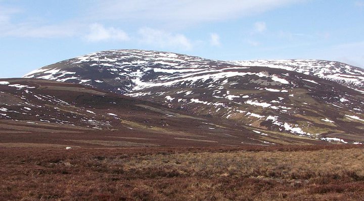
England’s least-populated national park runs from Hadrian’s Wall north through empty grasslands to the Cheviot Hills on the Scottish border. The Cheviot (816 m) tops broad, grassy, often boggy hills where paths are sparse and navigation skills matter.

- Country
- England
- Area
- 1,048 km²
- Designated
- 1956
- Listed hills
- 21
- Highest listed hill
- The Cheviot 816 m
Access in this park
Extensive CRoW open access land covers the Cheviot massif and much of the moorland; wild camping needs the landowner’s permission. Live firing closes parts of the Otterburn ranges — check published firing times.
Conditional Right to roam (England): Right to roam only on mapped CRoW open access land.
Conditional Wild camping (England): Permission needed — except on the Dartmoor commons.
Designation as a park creates no right of access in itself — the law of England applies inside the boundary, and park byelaws, seasonal restrictions and closures can override the general position. This is general information, not legal advice. Full detail:access rights in England ·check a specific grid reference.
All 21 listed hills, tallest first
Every summit from our hill dataset whose summit point falls inside the park boundary. Follow a name for its full record, live summit weather and daylight times.
| # | Hill | Height | Classifications | Grid ref |
|---|---|---|---|---|
| 1 | The Cheviot | 816 m | HewittNuttallHistoric County Top+5 | NT907205 |
| 2 | Cairn Hill West Top | 743 m | Donald TopHistoric County Top | NT895193 |
| 3 | Hedgehope Hill | 714.4 m | HewittNuttallHuMP+1 | NT943197 |
| 4 | Comb Fell | 652.8 m | HewittNuttallSimm | NT924187 |
| 5 | Cushat Law | 616.2 m | HewittNuttallHuMP+1 | NT928137 |
| 6 | Bloodybush Edge | 609.8 m | HewittNuttallHuMP+1 | NT902143 |
| 7 | The Schil | 605.5 m | HuMPSimmDewey | NT869223 |
| 8 | Dunmoor Hill | 569 m | Dewey | NT967182 |
| 9 | Wether Cairn | 563 m | Dewey | NT940116 |
| 10 | Thirl Moor | 558 m | HuMPDewey | NT806083 |
| 11 | Black Hag | 549 m | Dewey | NT861237 |
| 12 | Yarnspath Law | 540.5 m | Dewey | NT887135 |
| 13 | Newton Tors | 537 m | HuMPDewey | NT908269 |
| 14 | Shill Moor | 528.8 m | HuMPDewey | NT943153 |
| 15 | Ravens Knowe | 527 m | Dewey | NT780062 |
| 16 | Preston Hill | 526 m | HuMPDewey | NT922237 |
| 17 | Broadhope Hill | 517 m | Dewey | NT932234 |
| 18 | Lint Lands | 510.4 m | Dewey | NT902163 |
| 19 | Brownhart Law | 508 m | Dewey | NT787093 |
| 20 | Hungry Law | 501 m | Dewey | NT747061 |
| 21 | Shillhope Law | 501 m | MarilynHuMPDewey | NT873096 |
Hill data from the Database of British & Irish Hills v18.3 (CC BY 4.0); park boundaries from the Office for National Statistics (OGL v3.0). Hills are assigned to a park by summit position, so a top just outside the boundary will not appear here even if the walk starts inside it.
Long-distance paths through Northumberland
3 waymarked long-distance routes cross the park boundary. Distances are for the whole route, not just the section inside the park.
| Route | Total length | Countries |
|---|---|---|
| Pennine WayNational Trail | 411 km · 256 mi | England, Scotland |
| Hadrian's Wall PathNational Trail | 138 km · 86 mi | England |
| Saint Cuthbert's WayNational Trail | 104 km · 65 mi | Scotland, England |
Route lines © OpenStreetMap contributors (ODbL); park crossings computed by OpenFell against the ONS park boundary. See all UK long-distance paths.
Plan a walk here
- Walking-time calculator — Naismith with terrain and fitness corrections.
- Daylight safety planner — set your turnaround against sunset.
- Access checker — what a specific grid reference allows.
- Access rights in England — roaming, paths, camping and dogs in detail.
- Safety notes — conditions change fast; build in margin.