The Cheviot
5 classifications here — Current County/UA Top, Trail 100, Marilyn, HuMP and Simm — belong to lists OpenFell holds only part of, so they have no list page. See how far the coverage goes.

- Height
- 816 m · 2,677 ft
- Prominence
- 557.5 m
- Grid reference
- NT 90782 20526
- Coordinates
- 55.47850, -2.14739
- County / area
- Northumberland
- County top
- Highest point of Northumberland
- Region
- Northumberland
- OS Landranger
- 74 75
- OS Explorer
- OL16E
- Summit feature
- no feature: heather
- Key col
- NT 4041 0064 (258.5 m)
About The Cheviot
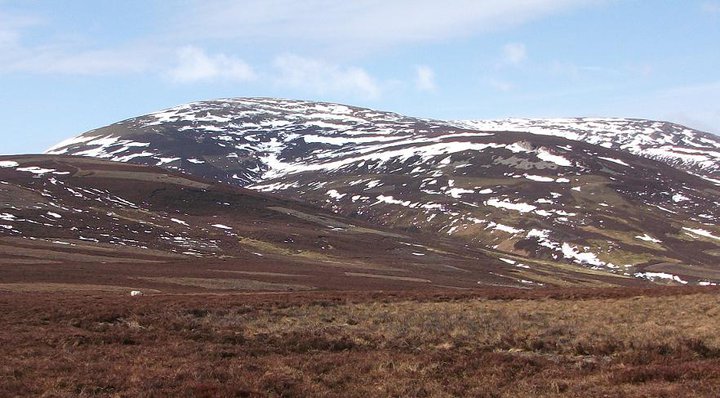
The Cheviot is an extinct volcano and the highest ground both in the Cheviot Hills and in Northumberland, in the far north of England. It lies about 2 kilometres from the Scottish border, on the last few miles of the Pennine Way before the route drops to Kirk Yetholm.
Melting within the crust over 390 million years ago produced the volcanic activity that built the hill, forming a stratovolcano and pluton; heavy erosion has worked on it since. A number of watercourses radiate outwards from the summit.
Background written from facts in the Wikipedia article on The Cheviot (CC BY-SA 4.0). Heights, prominence and grid references come from the Database of British & Irish Hills, not from Wikipedia.
Access rights here
Conditional Right to roam: Right to roam only on mapped CRoW open access land.
Permission needed Wild camping: Needs the landowner's permission — the Dartmoor commons are the only exception in England.
General position for England — local byelaws, seasonal restrictions and closures can override it. Full details: access rights in England ·check another location.
Daylight at this summit today
- Sunrise
- —
- Sunset
- —
- Daylight
- —
- Civil twilight ends
- —
Computed astronomically for 55.478, -2.147. Plan your finish with the daylight safety planner.
Summit weather live
Loading forecast for the summit (816 m)…
Forecast adjusted to summit altitude. Weather data from MET Norway (CC BY 4.0).
Finding the summit
ground 10m SE at NT 90786 20518 is of similar height; ground by trig point at NT 90781 20526 is 0.7m lower.
The recorded summit point is no feature: heather. That distinction matters on broad or flat tops, where the obvious cairn is not always the true high point.
- Record revised
- 03-Jun-24
- Drop measured from
- NT 4041 0064 · 258.5 m
Survey notes are field observations recorded in the Database of British & Irish Hills (v18.3, CC BY 4.0) by the hill-surveying community.
Long-distance paths past this hill
One waymarked long-distance route runs within 2.5 km of the summit — useful if you are linking this hill into a longer walk, or want a made path for the approach.
| Route | Total length | From summit |
|---|---|---|
| Pennine Way | 411 km | 1.7 km |
Route lines © OpenStreetMap contributors (ODbL); distance from the summit computed by OpenFell.
The The Cheviot group
22 other listed summits sit in the same prominence group, with The Cheviot as the independent hill at its head.
| Summit | Height | Drop |
|---|---|---|
| Cairn Hill West Top | 743 m | 5 m |
| Hedgehope Hill | 714 m | 147 m |
| Comb Fell | 653 m | 70 m |
| Windy Gyle | 619 m | 113 m |
| Cushat Law | 616 m | 149 m |
| Bloodybush Edge | 610 m | 114 m |
| The Schil | 606 m | 136 m |
| Dunmoor Hill | 569 m | 98 m |
| Wether Cairn | 563 m | 67 m |
| Beefstand Hill | 562 m | 70 m |
| Thirl Moor | 558 m | 132 m |
| Black Hag | 549 m | 66 m |
Twelve highest shown, of 22 in the group.
Grouping is by prominence alone: a summit belongs to the nearest higher Marilyn it connects to without a deeper intervening col. Over a large massif that can gather hills no one would walk in a single day, and which few would describe as parts of the same mountain — it is a measure of independence, not a suggested route.
Nearest listed peaks
| Peak | Height | Distance |
|---|---|---|
| Cairn Hill West Top | 743 m | 1.7 km |
| Comb Fell | 652.8 m | 2.4 km |
| Preston Hill | 526 m | 3.6 km |
| Birnie Brae | 508 m | 3.6 km |
| Hedgehope Hill | 714.4 m | 3.7 km |
| Broadhope Hill | 517 m | 3.8 km |