Moel Druman
One classification here — Simm — belongs to a list OpenFell holds only part of, so it has no list page. See how far the coverage goes.
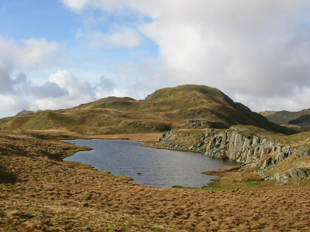

- Height
- 676 m · 2,218 ft
- Prominence
- 58 m
- Grid reference
- SH 67162 47645
- Coordinates
- 53.00957, -3.98138
- County / area
- Gwynedd
- Region
- Snowdonia
- OS Landranger
- 115
- OS Explorer
- OL17W
- Summit feature
- rocky outcrop N of fence
- Key col
- SH674476 (618 m)
About Moel Druman
Moel Druman is part of the Moelwynion in Snowdonia, and is a subsidiary summit of Allt-fawr rather than an independent mountain.
Background written from facts in the Wikipedia article on Moel Druman (CC BY-SA 4.0). Heights, prominence and grid references come from the Database of British & Irish Hills, not from Wikipedia.
Access rights here
Conditional Right to roam: Right to roam only on mapped CRoW open access land.
Permission needed Wild camping: Permission needed everywhere.
General position for Wales — local byelaws, seasonal restrictions and closures can override it. Full details: access rights in Wales ·check another location.
Daylight at this summit today
- Sunrise
- —
- Sunset
- —
- Daylight
- —
- Civil twilight ends
- —
Computed astronomically for 53.010, -3.981. Plan your finish with the daylight safety planner.
Summit weather live
Loading forecast for the summit (676 m)…
Forecast adjusted to summit altitude. Weather data from MET Norway (CC BY 4.0).
Finding the summit
ground 14m W and just S of fence is 0.3m lower.
The recorded summit point is rocky outcrop N of fence. That distinction matters on broad or flat tops, where the obvious cairn is not always the true high point.
- Survey method
- Abney level
- Record revised
- 23-Oct-23
- Drop measured from
- SH674476 · 618 m
Survey notes are field observations recorded in the Database of British & Irish Hills (v18.3, CC BY 4.0) by the hill-surveying community.
Long-distance paths past this hill
One waymarked long-distance route runs within 2.5 km of the summit — useful if you are linking this hill into a longer walk, or want a made path for the approach.
| Route | Total length | From summit |
|---|---|---|
| Snowdonia Slate Trail | 135 km | 1 km |
Route lines © OpenStreetMap contributors (ODbL); distance from the summit computed by OpenFell.
Reaching Moel Druman by train
3 National Rail stations sit within 8 km of the summit — close enough to make a car-free day of it. Distances are straight lines, not walking routes.
| Station | From summit | Summit lies |
|---|---|---|
| Blaenau Ffestiniog | 3.3 km | NW of the station |
| Roman Bridge | 5.6 km | SW of the station |
| Dolwyddelan | 8 km | SW of the station |
Each station page lists every hill in its reach, long-distance paths from the door and a live-times link — see all stations with hills in reach. Station positions from NaPTAN (OGL v3.0).
Get food nearby
3 places to eat or drink within 10 km of the summit, rated under the Food Hygiene Rating Scheme (Scotland runs its own Food Hygiene Information Scheme, a pass/fail equivalent).
| Place | Type | Rating | Distance |
|---|---|---|---|
| Kings Head | Pub/bar/nightclub | 5 out of 5 | 2.7 km · SE |
| Zip World Llechwedd Caffi | Restaurant/Cafe/Canteen | 5 out of 5 | 2.7 km · E |
| Lakeside Cafe (Y Fuddau) | Restaurant/Cafe/Canteen | 5 out of 5 | 2.9 km · SE |
Classifications and ratings are the local authority's own and can be coarse — this is a lead, not a guarantee of opening hours or that food is served to non-residents. Follow a name through to the official rating page to check, and confirm before you rely on it.
Food hygiene data from the Food Standards Agency and Food Standards Scotland (Open Government Licence v3.0). Distances and directions computed by OpenFell from the summit.
Which hill this one belongs to
Moel Druman is not counted as an independent hill in its own right. In prominence terms it belongs to Allt-fawr (698 m) — the nearest Marilyn you can reach from this summit without first dropping below its key col, 618 m.
Grouping is by prominence alone: a summit belongs to the nearest higher Marilyn it connects to without a deeper intervening col. Over a large massif that can gather hills no one would walk in a single day, and which few would describe as parts of the same mountain — it is a measure of independence, not a suggested route.
Nearest listed peaks
| Peak | Height | Distance |
|---|---|---|
| Ysgafell Wen | 672.2 m | 0.7 km |
| Allt-fawr | 697.9 m | 1 km |
| Ysgafell Wen North Top | 669.4 m | 1.2 km |
| Ysgafell Wen Far North Top | 659 m | 1.4 km |
| Craig Nyth-y-Gigfran | 554 m | 1.8 km |
| Moel-yr-hydd | 648 m | 2.2 km |