Walks from Llanfairfechan station
12 listed hills have a summit within 8 km of the platform at Llanfairfechan — the closest is Foel-ganol at 3.7 km, the highest Foel-fras at 944 m. Distances are straight lines, not routes: this page tells you a car-free day is possible here, and the planning is still yours.
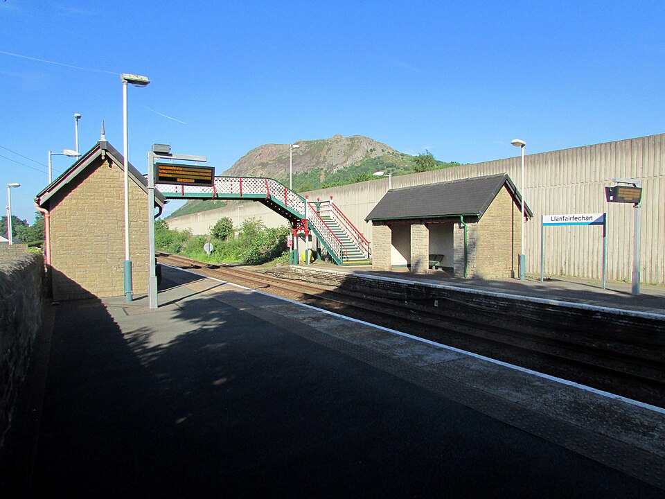
.jpg)
- Station code
- LLF
- Grid reference
- SH678752
- Coordinates
- 53.25729, -3.98320
- Locality
- Llanfairfechan
- Operator
- TfW Rail
- Entries & exits
- 37,652 · #2,142 of 2,589
- Hills in reach
- 12
Passenger figure is the ORR estimate of all entries and exits, April 2024 to March 2025 — a measure of how busy (or wonderfully quiet) the station is, not of train frequency.
The 12 hills within 8 km
Every hill from our dataset for which Llanfairfechan is one of the 3 nearest stations. Follow a name for the full record — heights, prominence, access rights, live summit weather and daylight.
| # | Hill | Height | Classifications | From station | Direction |
|---|---|---|---|---|---|
| 1 | Foel-ganol | 536 m | Dewey | 3.7 km | S |
| 2 | Yr Orsedd | 559 m | Dewey | 4 km | SE |
| 3 | Foel Lwyd | 600.2 m | DeweySimm | 5.1 km | SE |
| 4 | Tal y Fan | 610 m | HewittNuttallMarilyn+2 | 5.7 km | SE |
| 5 | Llwytmor | 849 m | HewittNuttallSimm | 6.1 km | S |
| 6 | Moel Wnion | 579.9 m | DeweyHuMP | 6.2 km | SW |
| 7 | Drum | 771 m | HewittNuttallSimm | 6.4 km | SE |
| 8 | Bera Mawr | 793.7 m | Nuttall | 6.9 km | S |
| 9 | Gyrn | 541.3 m | Dewey | 7.1 km | SW |
| 10 | Foel-fras | 944.1 m | HewittNuttallFurth+1 | 7.3 km | S |
| 11 | Drosgl | 756.9 m | HewittNuttallSimm | 7.3 km | S |
| 12 | Bera Bach | 806.5 m | Nuttall | 7.4 km | S |
A hill 8 km away in a straight line can be a much longer day on the ground — and on rural lines the last train home leaves early and some stations are request stops with a handful of services a day. Check live times and facilities for Llanfairfechan before you commit, plan the route on a proper map, and give the daylight planner your real finish time.
Hill data from the Database of British & Irish Hills v18.3 (CC BY 4.0). Station position from NaPTAN (Department for Transport, OGL v3.0); passenger estimates from the Office of Rail and Road (OGL v3.0). Distances and bearings computed by OpenFell, summit to platform.
Long-distance paths from this station
3 waymarked long-distance routes pass within 2 km of the station — a made line to follow out of the door, or a way to link this station to the next one down the line.
| Route | Total length | From station |
|---|---|---|
| Wales Coast Path | 321 km | passes the station |
| North Wales Path | 97 km | 1.5 km |
| North Wales Pilgrim's Way | 51 km | 1.9 km |
Route lines © OpenStreetMap contributors (ODbL); distance from the station computed by OpenFell.
Daylight here today
- Sunrise
- —
- Sunset
- —
- Daylight
- —
- Civil twilight ends
- —
Computed astronomically for the station. Walking to a timetable means walking to the light: set your turnaround with the daylight safety planner.
Plan the day
- Walking-time calculator — Naismith with terrain and fitness corrections.
- Access checker — what the land around here allows.
- Kit-list generator — packed for the forecast, not for habit.
- Llanfairfechan on National Rail — live departures, facilities, engineering work.
- OS Maps · Google Maps