Walks from Arrochar and Tarbet station
11 listed hills have a summit within 8 km of the platform at Arrochar and Tarbet — the closest is Tullich Hill at 4.4 km, the highest Beinn Ime at 1,012 m. Distances are straight lines, not routes: this page tells you a car-free day is possible here, and the planning is still yours.

- Station code
- ART
- Grid reference
- NN312046
- Coordinates
- 56.20397, -4.72277
- Locality
- Arrochar
- Operator
- ScotRail
- Entries & exits
- 20,438 · #2,275 of 2,589
- Hills in reach
- 11
Passenger figure is the ORR estimate of all entries and exits, April 2024 to March 2025 — a measure of how busy (or wonderfully quiet) the station is, not of train frequency.
About Arrochar and Tarbet station
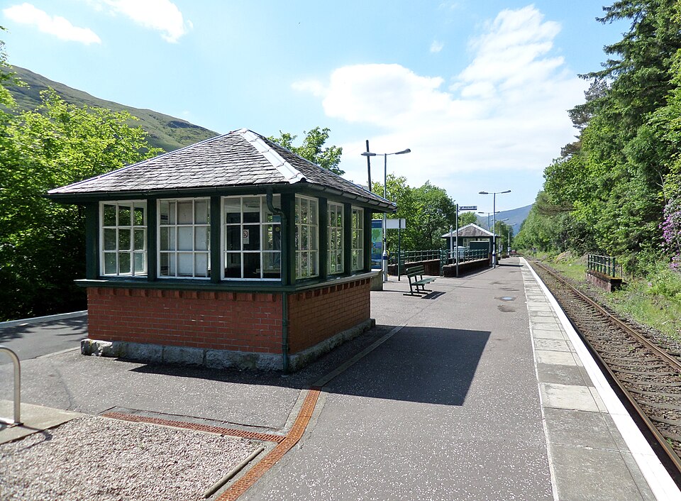
Arrochar and Tarbet station stands at the western, Arrochar, end of Tarbet on the West Highland Line, between Ardlui and Garelochhead, 19 miles 45 chains from Craigendoran Junction near Helensburgh. ScotRail manages the station and operates most services, with others provided by Caledonian Sleeper.
Background written from facts in the Wikipedia article on Arrochar and Tarbet railway station (CC BY-SA 4.0). Coordinates and the passenger figure come from NaPTAN and the ORR, not from Wikipedia.
The 11 hills within 8 km
Every hill from our dataset for which Arrochar and Tarbet is one of the 3 nearest stations. Follow a name for the full record — heights, prominence, access rights, live summit weather and daylight.
| # | Hill | Height | Classifications | From station | Direction |
|---|---|---|---|---|---|
| 1 | Tullich Hill | 633.1 m | GrahamMarilynHuMP+1 | 4.4 km | SW |
| 2 | Beinn Narnain | 926.8 m | MunroMurdoMarilyn+2 | 4.5 km | NW |
| 3 | Beinn Bhreac | 680.8 m | GrahamMarilynHuMP+1 | 4.6 km | S |
| 4 | Cruinn a' Bheinn | 632.5 m | GrahamMarilynHuMP+1 | 5.4 km | E |
| 5 | The Cobbler | 884 m | CorbettTrail 100Marilyn+2 | 5.4 km | W |
| 6 | Ben Lomond | 973.7 m | MunroHistoric County TopTrail 100+4 | 5.8 km | E |
| 7 | Ben Vane | 915.8 m | MunroMurdoMarilyn+2 | 6.3 km | NW |
| 8 | The Brack | 787.5 m | CorbettMarilynHuMP+1 | 6.8 km | W |
| 9 | Beinn Ime | 1012.2 m | MunroMurdoMarilyn+2 | 6.9 km | NW |
| 10 | Beinn Luibhean | 859.7 m | CorbettMarilynHuMP+1 | 7.6 km | NW |
| 11 | Doune Hill | 734.5 m | GrahamMarilynHuMP+1 | 7.8 km | S |
A hill 8 km away in a straight line can be a much longer day on the ground — and on rural lines the last train home leaves early and some stations are request stops with a handful of services a day. Check live times and facilities for Arrochar and Tarbet before you commit, plan the route on a proper map, and give the daylight planner your real finish time.
Hill data from the Database of British & Irish Hills v18.3 (CC BY 4.0). Station position from NaPTAN (Department for Transport, OGL v3.0); passenger estimates from the Office of Rail and Road (OGL v3.0). Distances and bearings computed by OpenFell, summit to platform.
Long-distance paths from this station
3 waymarked long-distance routes pass within 2 km of the station — a made line to follow out of the door, or a way to link this station to the next one down the line.
| Route | Total length | From station |
|---|---|---|
| Three Lochs Way | 54 km | passes the station |
| Loch Lomond and Cowal Way | 91 km | 1.3 km |
| Mary Queen of Scots Way | 42 km | 1.3 km |
Route lines © OpenStreetMap contributors (ODbL); distance from the station computed by OpenFell.
Daylight here today
- Sunrise
- —
- Sunset
- —
- Daylight
- —
- Civil twilight ends
- —
Computed astronomically for the station. Walking to a timetable means walking to the light: set your turnaround with the daylight safety planner.
Plan the day
- Walking-time calculator — Naismith with terrain and fitness corrections.
- Access checker — what the land around here allows.
- Kit-list generator — packed for the forecast, not for habit.
- Arrochar and Tarbet on National Rail — live departures, facilities, engineering work.
- OS Maps · Google Maps