Stuc an Lochain · Stuchd an Lochain
4 classifications here — Marilyn, HuMP, Simm and Murdo — belong to lists OpenFell holds only part of, so they have no list page. See how far the coverage goes.

- Height
- 959.5 m · 3,148 ft
- Prominence
- 481 m
- Grid reference
- NN 48308 44832
- Coordinates
- 56.57091, -4.47060
- County / area
- Perth and Kinross
- OS Landranger
- 51
- OS Explorer
- OL48W 378W
- Summit feature
- embedded rock 3m S of cairn
- Key col
- NN592513 (478 m)
About Stuc an Lochain
Stuchd an Lochain occupies the western end of Glen Lyon, in the Breadalbane country of the southern Highlands, forming the southern wall of Loch an Daimh.
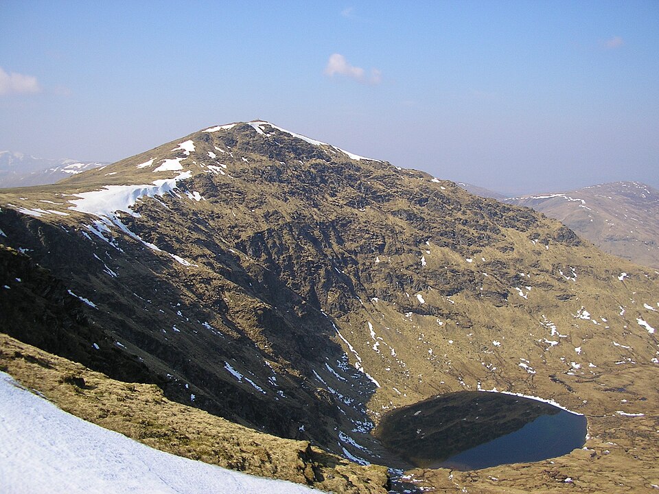
Its summit stands over a large corrie holding a small lochan, Lochan na Cat, which gives the hill much of its shape. The usual line of ascent starts at the eastern end of Loch an Daimh and takes the ridge over Sron Chona Choirein, turning north and then north-west for the top. A longer circuit of the loch adds the Corbett Sròn a' Choire Chnapanich and the Munro Meall Buidhe.
Background written from facts in the Wikipedia article on Stuchd an Lochain (CC BY-SA 4.0). Heights, prominence and grid references come from the Database of British & Irish Hills, not from Wikipedia.
Access rights here
Yes Right to roam: Statutory right of responsible access to most land and inland water.
Yes Wild camping: Wild camping is broadly lawful under the 2003 Act.
General position for Scotland — local byelaws, seasonal restrictions and closures can override it. Full details: access rights in Scotland ·check another location.
Daylight at this summit today
- Sunrise
- —
- Sunset
- —
- Daylight
- —
- Civil twilight ends
- —
Computed astronomically for 56.571, -4.471. Plan your finish with the daylight safety planner.
Summit weather live
Loading forecast for the summit (960 m)…
Forecast adjusted to summit altitude. Weather data from MET Norway (CC BY 4.0).
Finding the summit
The recorded summit point is embedded rock 3m S of cairn. On broad or flat summits the obvious cairn is not always the true high point.
- Survey method
- Abney level/Leica RX1250
- Record revised
- 15-Dec-24
- Drop measured from
- NN592513 · 478 m
Survey notes are field observations recorded in the Database of British & Irish Hills (v18.3, CC BY 4.0) by the hill-surveying community.
The Stuc an Lochain group
One other listed summit sits in the same prominence group, with Stuc an Lochain as the independent hill at its head.
| Summit | Height | Drop |
|---|---|---|
| Sron Chona Choirein | 926 m | 37 m |
Grouping is by prominence alone: a summit belongs to the nearest higher Marilyn it connects to without a deeper intervening col. Over a large massif that can gather hills no one would walk in a single day, and which few would describe as parts of the same mountain — it is a measure of independence, not a suggested route.
Nearest listed peaks
| Peak | Height | Distance |
|---|---|---|
| Sron Chona Choirein | 926.1 m | 1.1 km |
| Sron a' Choire Chnapanaich | 835 m | 2.7 km |
| Meall Buidhe | 932.1 m | 5.3 km |
| Meall nan Subh | 806 m | 5.5 km |
| Meall Buidhe | 908.4 m | 5.6 km |
| Meall Ghaordaidh | 1039.8 m | 6 km |