Creag Dhubh
3 classifications here — Marilyn, HuMP and Simm — belong to lists OpenFell holds only part of, so they have no list page. See how far the coverage goes.

- Height
- 659.6 m · 2,164 ft
- Prominence
- 332 m
- Grid reference
- NN 32277 82445
- Coordinates
- 56.90297, -4.75582
- County / area
- Highland
- OS Landranger
- 34 41
- OS Explorer
- 392 400
- Summit feature
- cairn
- Key col
- NN336834 (328 m)
About Creag Dhubh
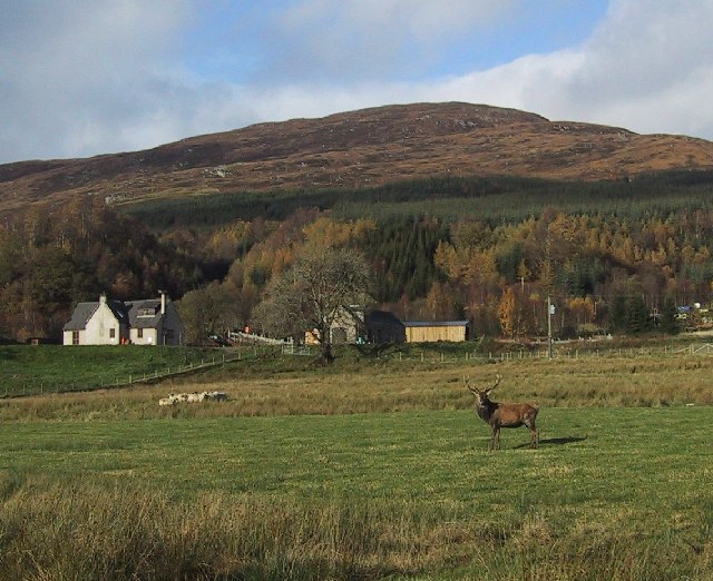
East of Roybridge in Lochaber, Creag Dhubh is a rounded Grampian hill that acts as a divide between two glens: Glen Spean to the south and the lower reaches of Glen Roy to the north. Its shape is unfussy rather than craggy, and at just under 660 m it qualifies as a Graham and a Marilyn.
Background written from facts in the Wikipedia article on Creag Dhubh (Roybridge) (CC BY-SA 4.0). Heights, prominence and grid references come from the Database of British & Irish Hills, not from Wikipedia.
Access rights here
Yes Right to roam: Statutory right of responsible access to most land and inland water.
Yes Wild camping: Wild camping is broadly lawful under the 2003 Act.
General position for Scotland — local byelaws, seasonal restrictions and closures can override it. Full details: access rights in Scotland ·check another location.
Daylight at this summit today
- Sunrise
- —
- Sunset
- —
- Daylight
- —
- Civil twilight ends
- —
Computed astronomically for 56.903, -4.756. Plan your finish with the daylight safety planner.
Summit weather live
Loading forecast for the summit (660 m)…
Forecast adjusted to summit altitude. Weather data from MET Norway (CC BY 4.0).
Finding the summit
trig point 20m WSW at NN 32260 82434 is about 1m lower.
The recorded summit point is cairn. That distinction matters on broad or flat tops, where the obvious cairn is not always the true high point.
- Survey method
- Abney level/Leica RX1250
- Record revised
- 23-Oct-23
- Drop measured from
- NN336834 · 328 m
Survey notes are field observations recorded in the Database of British & Irish Hills (v18.3, CC BY 4.0) by the hill-surveying community.
Long-distance paths past this hill
One waymarked long-distance route runs within 2.5 km of the summit — useful if you are linking this hill into a longer walk, or want a made path for the approach.
| Route | Total length | From summit |
|---|---|---|
| East Highland Way | 125 km | 1.9 km |
Route lines © OpenStreetMap contributors (ODbL); distance from the summit computed by OpenFell.
Reaching Creag Dhubh by train
2 National Rail stations sit within 8 km of the summit — close enough to make a car-free day of it. Distances are straight lines, not walking routes.
| Station | From summit | Summit lies |
|---|---|---|
| Tulloch | 3.9 km | NW of the station |
| Roy Bridge | 5.2 km | E of the station |
Each station page lists every hill in its reach, long-distance paths from the door and a live-times link — see all stations with hills in reach. Station positions from NaPTAN (OGL v3.0).
Get food nearby
2 places to eat or drink within 10 km of the summit, rated under the Food Hygiene Rating Scheme (Scotland runs its own Food Hygiene Information Scheme, a pass/fail equivalent).
| Place | Type | Rating | Distance |
|---|---|---|---|
| Corriechoille Lodge | Hotel/bed & breakfast/guest house | Awaiting inspection | 7.4 km · W |
| Lochaber Camanachd Club | Restaurant/Cafe/Canteen | Awaiting inspection | 9.6 km · W |
Classifications and ratings are the local authority's own and can be coarse — this is a lead, not a guarantee of opening hours or that food is served to non-residents. Follow a name through to the official rating page to check, and confirm before you rely on it.
Food hygiene data from the Food Standards Agency and Food Standards Scotland (Open Government Licence v3.0). Distances and directions computed by OpenFell from the summit.
Nearest listed peaks
| Peak | Height | Distance |
|---|---|---|
| Beinn Teallach | 914.6 m | 5.2 km |
| Cnap Cruinn | 741.9 m | 5.3 km |
| Leana Mhor | 676.8 m | 5.5 km |
| Carn Dearg | 834.4 m | 6.6 km |
| Leana Mhor | 683.9 m | 6.6 km |
| Beinn a' Chaorainn South Top | 1048.5 m | 6.7 km |