Ben Loyal - An Caisteal
3 classifications here — Marilyn, HuMP and Simm — belong to lists OpenFell holds only part of, so they have no list page. See how far the coverage goes.

- Height
- 764.2 m · 2,507 ft
- Prominence
- 609 m
- Grid reference
- NC 57812 48848
- Coordinates
- 58.40493, -4.43503
- County / area
- Highland
- Region
- Durness to Loch Shin
- OS Landranger
- 10
- OS Explorer
- 447S
- Summit feature
- rock slab 7m E of trig point
- Key col
- NC518443 (155 m)
About Ben Loyal - An Caisteal
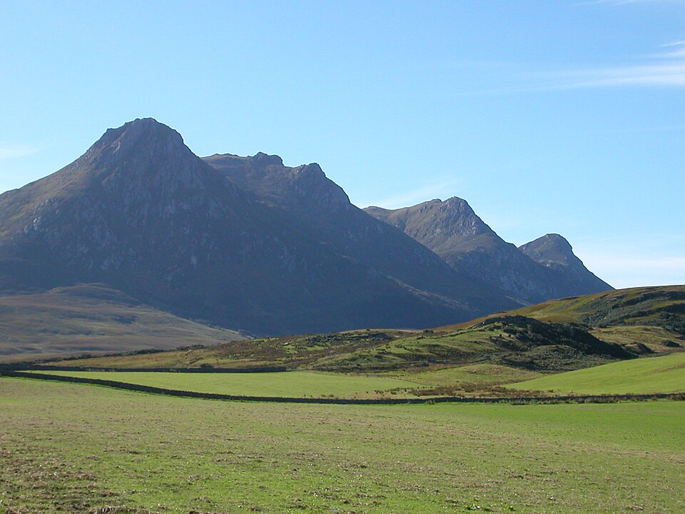
An Caisteal is the highest of the four rocky peaks that give Ben Loyal its distinctive profile — an isolated Sutherland mountain south of the Kyle of Tongue, at the north-western tip of the Highlands.
The other three tops are Sgòr Chaonasaid (712 m) to the north, Bheinn Bheag (744 m) to the south, and the ridge of Sgòr a Chèirich, 644 m at its highest, to the west; Sgòr Fionnaich reaches 568 m. The mountain is built chiefly of granite, specifically syenite.
From the summit there are views over the Kyle, east to Loch Loyal and west to Ben Hope. The name, from Scottish Gaelic Beinn Laghail, is thought to mean "law mountain", though the derivation through the modern Gaelic form is not certain.
Background written from facts in the Wikipedia article on Ben Loyal (CC BY-SA 4.0). Heights, prominence and grid references come from the Database of British & Irish Hills, not from Wikipedia.
Access rights here
Yes Right to roam: Statutory right of responsible access to most land and inland water.
Yes Wild camping: Wild camping is broadly lawful under the 2003 Act.
General position for Scotland — local byelaws, seasonal restrictions and closures can override it. Full details: access rights in Scotland ·check another location.
Daylight at this summit today
- Sunrise
- —
- Sunset
- —
- Daylight
- —
- Civil twilight ends
- —
Computed astronomically for 58.405, -4.435. Plan your finish with the daylight safety planner.
Summit weather live
Loading forecast for the summit (764 m)…
Forecast adjusted to summit altitude. Weather data from MET Norway (CC BY 4.0).
Finding the summit
rock 30m E at NC 57805 48830 is lower.
The recorded summit point is rock slab 7m E of trig point. That distinction matters on broad or flat tops, where the obvious cairn is not always the true high point.
- Survey method
- Leica Disto D510/Leica RX1250
- Record revised
- 17-Jul-14
- Drop measured from
- NC518443 · 155 m
Classification history: Col not surveyed - would need to be 154.6m or lower to retain P2000ft status.
Survey notes are field observations recorded in the Database of British & Irish Hills (v18.3, CC BY 4.0) by the hill-surveying community.
Nearest listed peaks
| Peak | Height | Distance |
|---|---|---|
| Ben Hope | 927 m | 10.1 km |
| Ben Klibreck - Meall nan Con | 962.1 m | 18.9 km |
| Beinn Direach | 688.9 m | 20.2 km |
| Carn an Tionail | 758.5 m | 21 km |
| Ben Hee | 873 m | 21.2 km |
| Sabhal Beag | 730.4 m | 21.3 km |