Ben Klibreck - Meall nan Con
4 classifications here — Marilyn, HuMP, Simm and Murdo — belong to lists OpenFell holds only part of, so they have no list page. See how far the coverage goes.

- Height
- 962.1 m · 3,156 ft
- Prominence
- 819 m
- Grid reference
- NC 58531 29908
- Coordinates
- 58.23520, -4.41113
- County / area
- Highland
- Region
- Altnaharra to Dornoch
- OS Landranger
- 16
- OS Explorer
- 443
- Summit feature
- large rock 5m E of trig point
- Key col
- NC364331 (143 m)
About Ben Klibreck - Meall nan Con
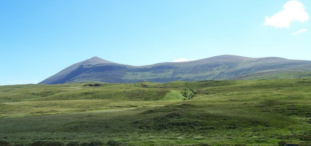
Ben Klibreck, in Gaelic Beinn Chlìbric, stands alone in central Sutherland, lifting out of a wide sweep of moorland with no close rivals. Meall nan Con, the mound of the dogs, is its high point at 962 m, and the only Munro further north is Ben Hope.
The two flanks differ markedly. The western side is a broadly uniform, steep slope of heather, while the eastern side breaks into a run of large grassy corries and is generally reckoned the more characterful. Ascents can be made from Crask to the south or Altnaharra to the north, with the western approach from the A836 past Loch nan Uan the one most walkers take.
Background written from facts in the Wikipedia article on Ben Klibreck (CC BY-SA 4.0). Heights, prominence and grid references come from the Database of British & Irish Hills, not from Wikipedia.
Access rights here
Yes Right to roam: Statutory right of responsible access to most land and inland water.
Yes Wild camping: Wild camping is broadly lawful under the 2003 Act.
General position for Scotland — local byelaws, seasonal restrictions and closures can override it. Full details: access rights in Scotland ·check another location.
Daylight at this summit today
- Sunrise
- —
- Sunset
- —
- Daylight
- —
- Civil twilight ends
- —
Computed astronomically for 58.235, -4.411. Plan your finish with the daylight safety planner.
Summit weather live
Loading forecast for the summit (962 m)…
Forecast adjusted to summit altitude. Weather data from MET Norway (CC BY 4.0).
Finding the summit
rock is 40cm higher than flush bracket.
The recorded summit point is large rock 5m E of trig point. That distinction matters on broad or flat tops, where the obvious cairn is not always the true high point.
- Survey method
- Leica RX1250
- Record revised
- 19-Mar-13
- Drop measured from
- NC364331 · 143 m
Survey notes are field observations recorded in the Database of British & Irish Hills (v18.3, CC BY 4.0) by the hill-surveying community.
Get food nearby
3 places to eat or drink within 10 km of the summit, rated under the Food Hygiene Rating Scheme (Scotland runs its own Food Hygiene Information Scheme, a pass/fail equivalent).
| Place | Type | Rating | Distance |
|---|---|---|---|
| Inver Lodge Hotel | Hotel/bed & breakfast/guest house | Pass | 5.5 km · W |
| Rhiconich Hotel | Hotel/bed & breakfast/guest house | Pass | 5.5 km · W |
| The Altnaharra Hotel Ltd | Hotel/bed & breakfast/guest house | Pass | 5.5 km · N |
Classifications and ratings are the local authority's own and can be coarse — this is a lead, not a guarantee of opening hours or that food is served to non-residents. Follow a name through to the official rating page to check, and confirm before you rely on it.
Food hygiene data from the Food Standards Agency and Food Standards Scotland (Open Government Licence v3.0). Distances and directions computed by OpenFell from the summit.
Nearest listed peaks
| Peak | Height | Distance |
|---|---|---|
| Ben Armine | 705.3 m | 11.2 km |
| Creag Mhor | 712.6 m | 12.7 km |
| Ben Hee | 873 m | 16.3 km |
| Ben Loyal - An Caisteal | 764.2 m | 18.9 km |
| Beinn Direach | 688.9 m | 19.6 km |
| Carn an Tionail | 758.5 m | 21.3 km |