
- Height
- 1032 m · 3,386 ft
- Prominence
- 13 m
- Grid reference
- NH 15764 27281
- Coordinates
- 57.29891, -5.05955
- County / area
- Highland
- Region
- Loch Duich to Cannich
- OS Landranger
- 25
- OS Explorer
- 414N 415
- Summit feature
- cairn
- Key col
- NH158272 (1019 m)
About Tom a' Choinich Beag
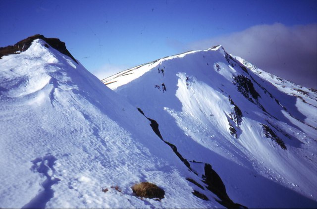
Tom a' Choinich Beag is a 1,032-metre Munro Top in the Northwest Highlands of Scotland, lying less than a kilometre west of its parent mountain, Tom a' Chòinich, a Munro of 1,112 metres. The surrounding ground falls to Glen Affric in the south and Loch Mullardoch in the north, with Càrn Eige — itself the parent peak of Tom a' Chòinich — some four kilometres west of that mountain.
Tom a' Chòinich can be climbed from Glen Cannich, but an approach from Glen Affric is more straightforward, using a path that heads north-west from the north shore of Loch Beinn a' Mheadhoin and follows Gleann nam Fiadh upstream. This path crosses Bealach Toll Easa, once the pass on the route between Affric Lodge and Benula Lodge before the latter was lost beneath the reservoir created at Loch Mullardoch.
Background written from facts in the Wikipedia article on Tom a' Chòinich (CC BY-SA 4.0). Heights, prominence and grid references come from the Database of British & Irish Hills, not from Wikipedia.
Access rights here
Yes Right to roam: Statutory right of responsible access to most land and inland water.
Yes Wild camping: Wild camping is broadly lawful under the 2003 Act.
General position for Scotland — local byelaws, seasonal restrictions and closures can override it. Full details: access rights in Scotland ·check another location.
Daylight at this summit today
- Sunrise
- —
- Sunset
- —
- Daylight
- —
- Civil twilight ends
- —
Computed astronomically for 57.299, -5.060. Plan your finish with the daylight safety planner.
Summit weather live
Loading forecast for the summit (1032 m)…
Forecast adjusted to summit altitude. Weather data from MET Norway (CC BY 4.0).
Which hill this one belongs to
Tom a' Choinich Beag is not counted as an independent hill in its own right. In prominence terms it belongs to Carn Eighe (1,183 m) — the nearest Marilyn you can reach from this summit without first dropping below its key col, 1,019 m.
Grouping is by prominence alone: a summit belongs to the nearest higher Marilyn it connects to without a deeper intervening col. Over a large massif that can gather hills no one would walk in a single day, and which few would describe as parts of the same mountain — it is a measure of independence, not a suggested route.
Nearest listed peaks
| Peak | Height | Distance |
|---|---|---|
| An Leth-chreag | 1051.7 m | 0.5 km |
| Tom a' Choinnich | 1112.7 m | 0.6 km |
| Sron Garbh | 1131 m | 1.6 km |
| Toll Creagach West Top | 951.3 m | 2 km |
| Stob Coire Dhomhnuill | 1139.1 m | 2.2 km |
| Stob a' Choire Dhomhain | 1146.5 m | 2.8 km |