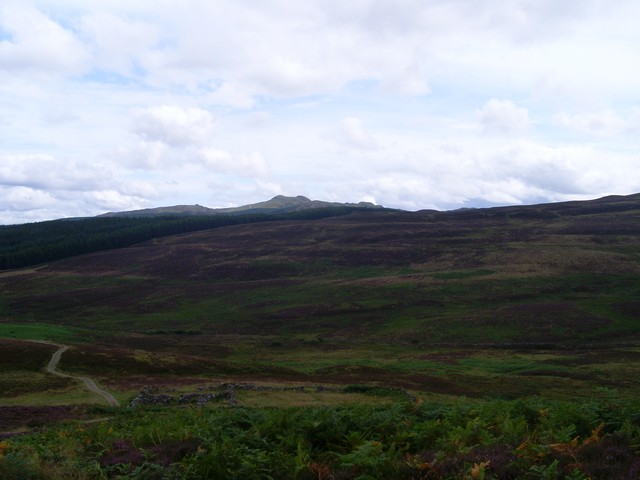
Meall Tairneachan
3 classifications here — Marilyn, HuMP and Simm — belong to lists OpenFell holds only part of, so they have no list page. See how far the coverage goes.

- Height
- 787 m · 2,582 ft
- Prominence
- 420 m
- Grid reference
- NN 80747 54369
- Coordinates
- 56.66590, -3.94741
- County / area
- Perth and Kinross
- OS Landranger
- 52
- OS Explorer
- OL49E 386E
- Summit feature
- trig point
- Key col
- NN775544 (367 m)
About Meall Tairneachan
Meall Tairneachan lies north-west of Aberfeldy in Perthshire, among rocky rolling moorland between Loch Tummel and the town. A baryte mine works close to the summit.
The hill is part of the Grampian Mountains, reaches 787 m and is a Corbett.
Background written from facts in the Wikipedia article on Meall Tàirneachan (CC BY-SA 4.0). Heights, prominence and grid references come from the Database of British & Irish Hills, not from Wikipedia.
Access rights here
Yes Right to roam: Statutory right of responsible access to most land and inland water.
Yes Wild camping: Wild camping is broadly lawful under the 2003 Act.
General position for Scotland — local byelaws, seasonal restrictions and closures can override it. Full details: access rights in Scotland ·check another location.
Daylight at this summit today
- Sunrise
- —
- Sunset
- —
- Daylight
- —
- Civil twilight ends
- —
Computed astronomically for 56.666, -3.947. Plan your finish with the daylight safety planner.
Summit weather live
Loading forecast for the summit (787 m)…
Forecast adjusted to summit altitude. Weather data from MET Norway (CC BY 4.0).
Finding the summit
The recorded summit point is trig point. On broad or flat summits the obvious cairn is not always the true high point.
- Survey method
- obvious summit
- Record revised
- 28-Oct-01
- Drop measured from
- NN775544 · 367 m
Survey notes are field observations recorded in the Database of British & Irish Hills (v18.3, CC BY 4.0) by the hill-surveying community.
Get food nearby
3 places to eat or drink within 10 km of the summit, rated under the Food Hygiene Rating Scheme (Scotland runs its own Food Hygiene Information Scheme, a pass/fail equivalent).
| Place | Type | Rating | Distance |
|---|---|---|---|
| Highland Safaris | Restaurant/Cafe/Canteen | Pass | 5.3 km · S |
| The Weem Inn | Hotel/bed & breakfast/guest house | Pass | 5.8 km · SE |
| The Inn at Loch Tummel | Hotel/bed & breakfast/guest house | Pass | 5.9 km · N |
Classifications and ratings are the local authority's own and can be coarse — this is a lead, not a guarantee of opening hours or that food is served to non-residents. Follow a name through to the official rating page to check, and confirm before you rely on it.
Food hygiene data from the Food Standards Agency and Food Standards Scotland (Open Government Licence v3.0). Distances and directions computed by OpenFell from the summit.
Nearest listed peaks
| Peak | Height | Distance |
|---|---|---|
| Farragon Hill | 782.4 m | 3.4 km |
| Schiehallion | 1083.3 m | 9.3 km |
| Meall Liath | 1013.7 m | 11.8 km |
| Meall na Aighean | 981 m | 12.2 km |
| Carn Mairg | 1043 m | 12.6 km |
| Meall a' Bharr | 1003.2 m | 14.2 km |