Creagan na Beinne
3 classifications here — Marilyn, HuMP and Simm — belong to lists OpenFell holds only part of, so they have no list page. See how far the coverage goes.

- Height
- 889.1 m · 2,917 ft
- Prominence
- 460.7 m
- Grid reference
- NN 74442 36846
- Coordinates
- 56.50693, -4.04171
- County / area
- Perth and Kinross
- Region
- Loch Tay to Perth
- OS Landranger
- 51 52
- OS Explorer
- OL48E 378E
- Summit feature
- cairn
- Key col
- NN 7424 3441 (428.4 m)
About Creagan na Beinne
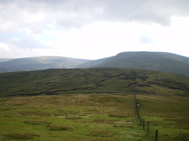
Creagan na Beinne belongs to the rolling hills and moors south-east of Loch Tay whose high point is Ben Chonzie. Glen Almond separates it from that parent hill, which is why it retains a considerable relative height of its own. In shape it is a large convex dome, cut deeply by corries, and the surrounding ground is grouse moor and sheep country.
The most straightforward approach comes from the north-west at Ardtalnaig, a hamlet on the shore of Loch Tay, using the north-west ridge; an alternative follows Gleann a' Chilleine to Dunan and takes the south ridge. The summit stands at 889.1 m.
Background written from facts in the Wikipedia article on Creagan na Beinne (CC BY-SA 4.0). Heights, prominence and grid references come from the Database of British & Irish Hills, not from Wikipedia.
Access rights here
Yes Right to roam: Statutory right of responsible access to most land and inland water.
Yes Wild camping: Wild camping is broadly lawful under the 2003 Act.
General position for Scotland — local byelaws, seasonal restrictions and closures can override it. Full details: access rights in Scotland ·check another location.
Daylight at this summit today
- Sunrise
- —
- Sunset
- —
- Daylight
- —
- Civil twilight ends
- —
Computed astronomically for 56.507, -4.042. Plan your finish with the daylight safety planner.
Summit weather live
Loading forecast for the summit (889 m)…
Forecast adjusted to summit altitude. Weather data from MET Norway (CC BY 4.0).
Finding the summit
The recorded summit point is cairn. On broad or flat summits the obvious cairn is not always the true high point.
- Survey method
- obvious summit/Leica RX1250
- Record revised
- 31-Oct-22
- Drop measured from
- NN 7424 3441 · 428.4 m
Survey notes are field observations recorded in the Database of British & Irish Hills (v18.3, CC BY 4.0) by the hill-surveying community.
Long-distance paths past this hill
One waymarked long-distance route runs within 2.5 km of the summit — useful if you are linking this hill into a longer walk, or want a made path for the approach.
| Route | Total length | From summit |
|---|---|---|
| Rob Roy Way | 176 km | 1.4 km |
Route lines © OpenStreetMap contributors (ODbL); distance from the summit computed by OpenFell.
Nearest listed peaks
| Peak | Height | Distance |
|---|---|---|
| Shee of Ardtalnaig | 758.2 m | 2.2 km |
| Creag Uchdag | 878.8 m | 5.8 km |
| Ben Chonzie | 930.4 m | 6.6 km |
| Auchnafree Hill | 787.4 m | 8.8 km |
| Beinn na Gainimh | 729.3 m | 9.5 km |
| Meall Greigh | 1001 m | 9.9 km |