Ben Macdui · Beinn Macduibh
6 classifications here — Current County/UA Top, Trail 100, Marilyn, HuMP, Simm and Murdo — belong to lists OpenFell holds only part of, so they have no list page. See how far the coverage goes.
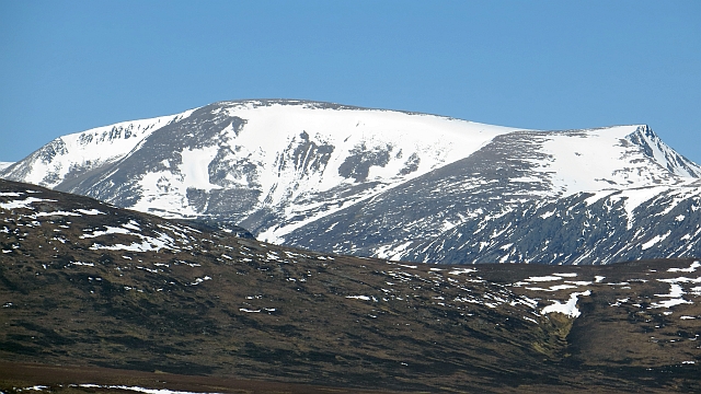

- Height
- 1309.3 m · 4,296 ft
- Prominence
- 950 m
- Grid reference
- NN 98900 98934
- Coordinates
- 57.07037, -3.66910
- County / area
- Aberdeenshire/Moray
- County top
- Highest point of Aberdeenshire/Moray
- Region
- Cairngorms
- OS Landranger
- 36 43
- OS Explorer
- OL57S 403S
- Summit feature
- trig point on large platform
- Key col
- NN632842 (359 m)
About Ben Macdui
Ben Macdui stands on the south-western rim of the Cairngorm plateau, with the Lairig Ghru pass falling away to the west and Loch Etchachan to the east. It is the highest of the Cairngorms and second only to Ben Nevis in Scotland and the British Isles, and it straddles the old county line between Aberdeenshire and Banffshire.
Which of the two was actually higher was an open question until the 19th century, when accurate mapping arrived; surveys in 1846–47 settled it in favour of Ben Nevis. On the summit is a direction indicator put up in 1925 by Aberdeen's Cairngorm Club in memory of Alexander Copland, a former president, pointing out the notable hills visible in clear conditions.
Background written from facts in the Wikipedia article on Ben Macdui (CC BY-SA 4.0). Heights, prominence and grid references come from the Database of British & Irish Hills, not from Wikipedia.
Access rights here
Yes Right to roam: Statutory right of responsible access to most land and inland water.
Yes Wild camping: Wild camping is broadly lawful under the 2003 Act.
General position for Scotland — local byelaws, seasonal restrictions and closures can override it. Full details: access rights in Scotland ·check another location.
Daylight at this summit today
- Sunrise
- —
- Sunset
- —
- Daylight
- —
- Civil twilight ends
- —
Computed astronomically for 57.070, -3.669. Plan your finish with the daylight safety planner.
Summit weather live
Loading forecast for the summit (1309 m)…
Forecast adjusted to summit altitude. Weather data from MET Norway (CC BY 4.0).
Finding the summit
The recorded summit point is trig point on large platform. On broad or flat summits the obvious cairn is not always the true high point.
- Survey method
- Leica RX1250
- Record revised
- 03-Jun-24
- Drop measured from
- NN632842 · 359 m
Classification history: Double county/UA top.
Survey notes are field observations recorded in the Database of British & Irish Hills (v18.3, CC BY 4.0) by the hill-surveying community.
The Ben Macdui group
10 other listed summits sit in the same prominence group, with Ben Macdui as the independent hill at its head.
| Summit | Height | Drop |
|---|---|---|
| Cairn Gorm | 1,245 m | 146 m |
| Cairn Lochan | 1,214 m | 91 m |
| Stob Coire an t-Sneachda | 1,176 m | 65 m |
| Derry Cairngorm | 1,156 m | 142 m |
| Cnap Coire na Spreidhe | 1,152 m | 15 m |
| Carn Etchachan | 1,120 m | 26 m |
| Sron Riach | 1,114 m | 23 m |
| Creagan a' Choire Etchachan | 1,107 m | 54 m |
| Creag an Leth-choin | 1,053 m | 56 m |
| Sgurr an Lochan Uaine | 983 m | 44 m |
Grouping is by prominence alone: a summit belongs to the nearest higher Marilyn it connects to without a deeper intervening col. Over a large massif that can gather hills no one would walk in a single day, and which few would describe as parts of the same mountain — it is a measure of independence, not a suggested route.
Nearest listed peaks
| Peak | Height | Distance |
|---|---|---|
| Sron Riach | 1113.7 m | 1.6 km |
| Carn Etchachan | 1120 m | 2.4 km |
| Creagan a' Choire Etchachan | 1107.2 m | 2.4 km |
| Sron na Lairige | 1184 m | 3 km |
| Derry Cairngorm | 1155.8 m | 3 km |
| Cairn Toul | 1291 m | 3.1 km |