Aonach Buidhe
3 classifications here — Marilyn, HuMP and Simm — belong to lists OpenFell holds only part of, so they have no list page. See how far the coverage goes.

- Height
- 899 m · 2,949 ft
- Prominence
- 474 m
- Grid reference
- NH 05765 32455
- Coordinates
- 57.34117, -5.22929
- County / area
- Highland
- Region
- Killilan to Inverness
- OS Landranger
- 25
- OS Explorer
- 414N 429
- Summit feature
- rock 1m E of cairn
- Key col
- NH077320 (425 m)
About Aonach Buidhe
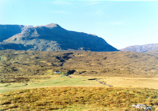
Remoteness is the defining fact about Aonach Buidhe, a 899 m hill in the Northwest Highlands of Ross and Cromarty. The nearest village is Dornie, and the customary approach comes in from the south-east through Glen Elchaig.
It is listed as a Corbett, along with Marilyn, HuMP and Simm.
Background written from facts in the Wikipedia article on Aonach Buidhe (CC BY-SA 4.0). Heights, prominence and grid references come from the Database of British & Irish Hills, not from Wikipedia.
Access rights here
Yes Right to roam: Statutory right of responsible access to most land and inland water.
Yes Wild camping: Wild camping is broadly lawful under the 2003 Act.
General position for Scotland — local byelaws, seasonal restrictions and closures can override it. Full details: access rights in Scotland ·check another location.
Daylight at this summit today
- Sunrise
- —
- Sunset
- —
- Daylight
- —
- Civil twilight ends
- —
Computed astronomically for 57.341, -5.229. Plan your finish with the daylight safety planner.
Summit weather live
Loading forecast for the summit (899 m)…
Forecast adjusted to summit altitude. Weather data from MET Norway (CC BY 4.0).
Finding the summit
summit 420m WNW at NH 05343 32568 is lower.
The recorded summit point is rock 1m E of cairn. That distinction matters on broad or flat tops, where the obvious cairn is not always the true high point.
- Survey method
- Abney level
- Record revised
- 15-Jan-03
- Drop measured from
- NH077320 · 425 m
Survey notes are field observations recorded in the Database of British & Irish Hills (v18.3, CC BY 4.0) by the hill-surveying community.
Long-distance paths past this hill
One waymarked long-distance route runs within 2.5 km of the summit — useful if you are linking this hill into a longer walk, or want a made path for the approach.
| Route | Total length | From summit |
|---|---|---|
| Cape Wrath Trail (Morvich → Bendronaig) | 30 km | 1.5 km |
Route lines © OpenStreetMap contributors (ODbL); distance from the summit computed by OpenFell.
Nearest listed peaks
| Peak | Height | Distance |
|---|---|---|
| Carn na Breabaig | 679 m | 2.5 km |
| Faochaig | 868 m | 3.6 km |
| An Socach | 1069 m | 4.4 km |
| An Cruachan | 705 m | 5 km |
| An Riabhachan West Top | 1038 m | 6.1 km |
| Beinn Dronaig | 796.8 m | 6.1 km |