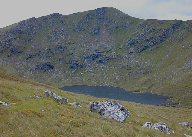
A' Chailleach
4 classifications here — Marilyn, HuMP, Simm and Murdo — belong to lists OpenFell holds only part of, so they have no list page. See how far the coverage goes.

- Height
- 998.6 m · 3,276 ft
- Prominence
- 182.9 m
- Grid reference
- NH 13624 71401
- Coordinates
- 57.69377, -5.12871
- County / area
- Highland
- Region
- The Fannaichs
- OS Landranger
- 19
- OS Explorer
- 435S
- Summit feature
- cairn on outcrop
- Key col
- NH 1441 7124 (815.6 m)
About A' Chailleach
A' Chailleach, Gaelic for the old woman, is the most westerly of the Fannichs in Wester Ross. That outlying position pays off at the top, where the outlook extends over the Fisherfield Forest and An Teallach.
It is generally walked in combination with Sgurr Breac. Kinlochewe, to the southwest, is the nearest village.
Background written from facts in the Wikipedia article on A' Chailleach (Fannichs) (CC BY-SA 4.0). Heights, prominence and grid references come from the Database of British & Irish Hills, not from Wikipedia.
Access rights here
Yes Right to roam: Statutory right of responsible access to most land and inland water.
Yes Wild camping: Wild camping is broadly lawful under the 2003 Act.
General position for Scotland — local byelaws, seasonal restrictions and closures can override it. Full details: access rights in Scotland ·check another location.
Daylight at this summit today
- Sunrise
- —
- Sunset
- —
- Daylight
- —
- Civil twilight ends
- —
Computed astronomically for 57.694, -5.129. Plan your finish with the daylight safety planner.
Summit weather live
Loading forecast for the summit (999 m)…
Forecast adjusted to summit altitude. Weather data from MET Norway (CC BY 4.0).
Finding the summit
The recorded summit point is cairn on outcrop. On broad or flat summits the obvious cairn is not always the true high point.
- Survey method
- obvious summit/Leica RX1250
- Record revised
- 11-Feb-21
- Drop measured from
- NH 1441 7124 · 815.6 m
Survey notes are field observations recorded in the Database of British & Irish Hills (v18.3, CC BY 4.0) by the hill-surveying community.
Nearest listed peaks
| Peak | Height | Distance |
|---|---|---|
| Toman Coinnich | 936.6 m | 1.2 km |
| Sgurr Breac | 999.6 m | 2.2 km |
| Groban | 749 m | 3.7 km |
| Sgurr nan Clach Geala | 1093 m | 4.8 km |
| Sgurr nan Each | 923 m | 5.1 km |
| Beinn Bheag | 668.4 m | 5.1 km |