Carn a' Chlamain
4 classifications here — Marilyn, HuMP, Simm and Murdo — belong to lists OpenFell holds only part of, so they have no list page. See how far the coverage goes.

- Height
- 963.5 m · 3,161 ft
- Prominence
- 317 m
- Grid reference
- NN 91592 75798
- Coordinates
- 56.86097, -3.77963
- County / area
- Perth and Kinross
- Region
- Glen Tromie to Glen Tilt
- OS Landranger
- 43
- OS Explorer
- OL51E 394E
- Summit feature
- cairn
- Key col
- NN888802 (646 m)
About Carn a' Chlamain
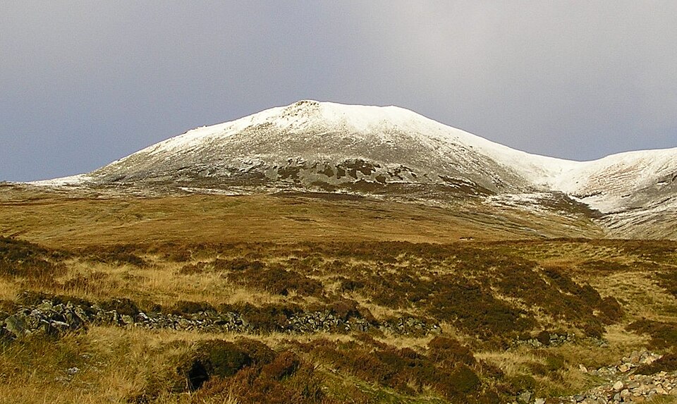
Carn a' Chlamain lies roughly 12 kilometres north of Blair Atholl in the Forest of Atholl, the high point of a rolling plateau northeast of Glen Tilt. Its summit is a conspicuous boulder-covered dome lifting out of the surrounding moorland.
The River Tarf, which feeds the Tilt, rises on the northwestern slopes and curves round the north side of the plateau, while another Tilt tributary marks the western edge.
Ascents come almost always from Glen Tilt. The common start is Forest Lodge, where a stalker's path zig-zags up the steep glen side before crossing the plateau; with no public vehicle access, the ten kilometres from Old Blair must be covered on foot or by bike. An alternative follows the southeast ridge, joined about three kilometres down the glen from the lodge.
Background written from facts in the Wikipedia article on Carn a' Chlamain (CC BY-SA 4.0). Heights, prominence and grid references come from the Database of British & Irish Hills, not from Wikipedia.
Access rights here
Yes Right to roam: Statutory right of responsible access to most land and inland water.
Yes Wild camping: Wild camping is broadly lawful under the 2003 Act.
General position for Scotland — local byelaws, seasonal restrictions and closures can override it. Full details: access rights in Scotland ·check another location.
Daylight at this summit today
- Sunrise
- —
- Sunset
- —
- Daylight
- —
- Civil twilight ends
- —
Computed astronomically for 56.861, -3.780. Plan your finish with the daylight safety planner.
Summit weather live
Loading forecast for the summit (964 m)…
Forecast adjusted to summit altitude. Weather data from MET Norway (CC BY 4.0).
Finding the summit
The recorded summit point is cairn. On broad or flat summits the obvious cairn is not always the true high point.
- Survey method
- obvious summit/Leica RX1250
- Record revised
- 30-Jan-15
- Drop measured from
- NN888802 · 646 m
Survey notes are field observations recorded in the Database of British & Irish Hills (v18.3, CC BY 4.0) by the hill-surveying community.
Nearest listed peaks
| Peak | Height | Distance |
|---|---|---|
| Beinn Mheadhonach | 900.9 m | 3.6 km |
| Beinn a' Ghlo - Braigh Coire Chruinn-bhalgain | 1070 m | 4.5 km |
| Beinn a' Ghlo - Carn nan Gabhar | 1121.9 m | 6 km |
| Airgiod Bheinn | 1061.7 m | 6 km |
| Beinn a' Ghlo - Carn Liath | 975.8 m | 6.3 km |
| Beinn Dearg | 1008.7 m | 6.6 km |